

Measuring systemLeica Geosystems
BLK3D




मूल आधारभूत जानकारी
- मशीन का नाम:
- Measuring system
- निर्माता:
- Leica Geosystems
- मॉडल:
- BLK3D
- मशीन नंबर:
- 4992660029
- निर्माण वर्ष:
- 2019
- स्थिति:
- बहुत अच्छा (इस्तेमाल किया हुआ)
- कार्यक्षमता:
- पूरी तरह से कार्यरत
- प्रचालन घंटे:
- 10 h
मूल्य और स्थान
- स्थान:
- 371 Chemin des Clauzes, 82160 Saint-Projet, France
तकनीकी विवरण
प्रलेखन और प्रमाणन
प्रस्ताव का विवरण
- विज्ञापन आईडी:
- A23290344
- अद्यतन:
- अंतिम बार 05.11.2026 को
विवरण
1 Leica BLK3D
1 Cable + charger
2 Batteries
1 Microfiber cloth
1 LED spotlight
1 Carrying case
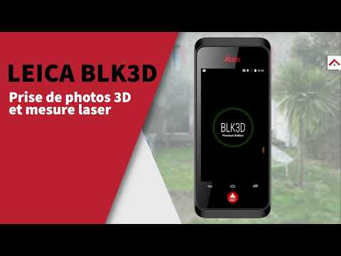
LEICA BLK3D – Professional 3D Photogrammetric Distance Meter
Selling a Leica BLK3D in perfect working condition – the benchmark photogrammetric measurement tool for professionals in the construction, surveying, and architecture industries.
Description
The BLK3D combines a calibrated stereo camera, measurement sensors, software, and integrated edge detection functions for image-based measurements with professional accuracy. (VERTICAL 3D)
The device is equipped with 2 stereo photo lenses, which allows for measuring all elements that appear in the photo in 3D. (STTL) Each photo taken constitutes a complete measurement record including height, width, and depth. (Kuker-Ranken)
Processing is done in real time directly within the device (edge computing), without the need for a network connection or cloud services. (Tavco)
Key Features
Integrated photogrammetry: instrument combining a camera, advanced algorithms, and instant processing.
Combined with electronic distance measurement technology.
Auto-targeting: visual recognition technology that allows you to select specific points for your measurements.
Construction site documentation: measure inaccessible areas, create plans, estimate building installations, document the progress of construction sites.
Collaboration: share measurements with your colleagues via the BLK3D software (mobile or desktop version), export to JPG, or create PDF reports.
Automatic geolocation: each image is time-stamped and associated with the exact GPS coordinates of the capture location. (Kuker-Ranken)
BIM/CAD integration: export to DWG/DXF for use in your CAD software, compatible with Autodesk BIM 360. (Kuker-Ranken)
Technical Specifications
Dimensions
180.6 × 77.6 × 27.1 mm
Weight
480 g
Tripod thread
1/4" (standard photo)
Cameras
2 × 10 MP, 80° angle, 4 mm focal length
Screen
5" IPS touchscreen, 720×1280 px
Processor
Snapdragon 820E Quadcore 2.35 GHz
Bodpfs Ah Etkox Aaxoww
RAM
4 GB
Internal storage
64 GB (~5,000 stereo photos)
OS
Android 7.1.2
Accuracy (good conditions)
±1 mm
Accuracy (poor conditions)
±2 mm
Maximum range
250 m (good conditions) / 120 m (poor)
Battery
3,880 mAh – battery life ~4h
Connectivity
Bluetooth 4.1, Wi-Fi 802.11 b/g/n, GPS+GLONASS
Ideal for:
Architects, surveyors, quantity surveyors, construction managers, building inspectors, engineering firms – any professional who needs to quickly take measurements on a construction site or during inspections.
International shipping is possible at your expense.
- Interested in this equipment?
Contact me via private message for more details or to discuss your 3D digitization needs!
इस विज्ञापन का स्वचालित रूप से अनुवाद किया गया है। अनुवाद में त्रुटियाँ संभव हैं।
आपूर्तिकर्ता
से पंजीकृत: 2026
5 ऑनलाइन विज्ञापन
अनुरोध भेजें
टेलीफ़ोन & फैक्स


 Saint-Projet
Leica GeosystemsBLK3D

Machineseeker-विश्वास प्रमाण पत्र
विश्वास मुहर क्या है?
Machineseeker चयनित विक्रेताओं को Machineseeker ट्रस्ट सील के साथ प्रमाणित करता है। जारी करने से पहले, अनुभवी Machineseeker कर्मचारी द्वारा एक मानकीकृत और व्यापक जांच की जाती है।
हम क्या जांचते हैं?

व्यावसायिक लाइसेंस या व्यापार रजिस्टर का अंश की जांच
विक्रेता के
डाक पते की जांच
बैंक कनेक्शन का सत्यापन
मुख्य नंबर की
टेलीफोनिक
उपलब्धता का सत्यापन
आर्थिक जानकारी
में कोई नकारात्मक विशेषताएँ नहीं होनी चाहिए
खरीदार की शिकायतें
से मुहर वापस ली जा सकती हैएक खरीदार के रूप में इसका आपके लिए क्या अर्थ है?
Machineseeker ट्रस्ट सील के माध्यम से, आप खरीदार के रूप में बिना अपनी जांच के भरोसेमंद विक्रेताओं की पहचान कर सकते हैं, जो अत्यधिक संभावना है कि ईमानदारी और सत्यनिष्ठा से व्यापार करते हैं।
बिल्कुल, खरीद प्रक्रिया के दौरान भी मतभेद हो सकते हैं। Machineseeker Machineseeker पर सक्रिय खरीदारों या विक्रेताओं द्वारा किए गए कानून के उल्लंघनों के लिए जिम्मेदार नहीं है।